Maryland Appalachian Trail Adventure
This weekend, we planned a memorial hike for Jonathan’s Dad, Mr. Ed. Mr. Ed loved to hike and camp and was heavily involved in Boy Scouts until his most recent health decline. He and Ms. Judy (his wife) always had a pack of neighborhood kids at the house and quietly kept the ‘fridge full as they knew many of us were food insecure at home.
To remember him, Dan, Jon, and I attempted to do the Maryland section of the AT which is about 41 miles. We made it halfway but still enjoyed ourselves (for the most part).
Penn-Mar to Raven Rock: 4.9 miles
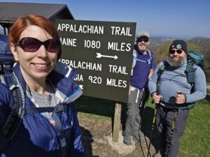
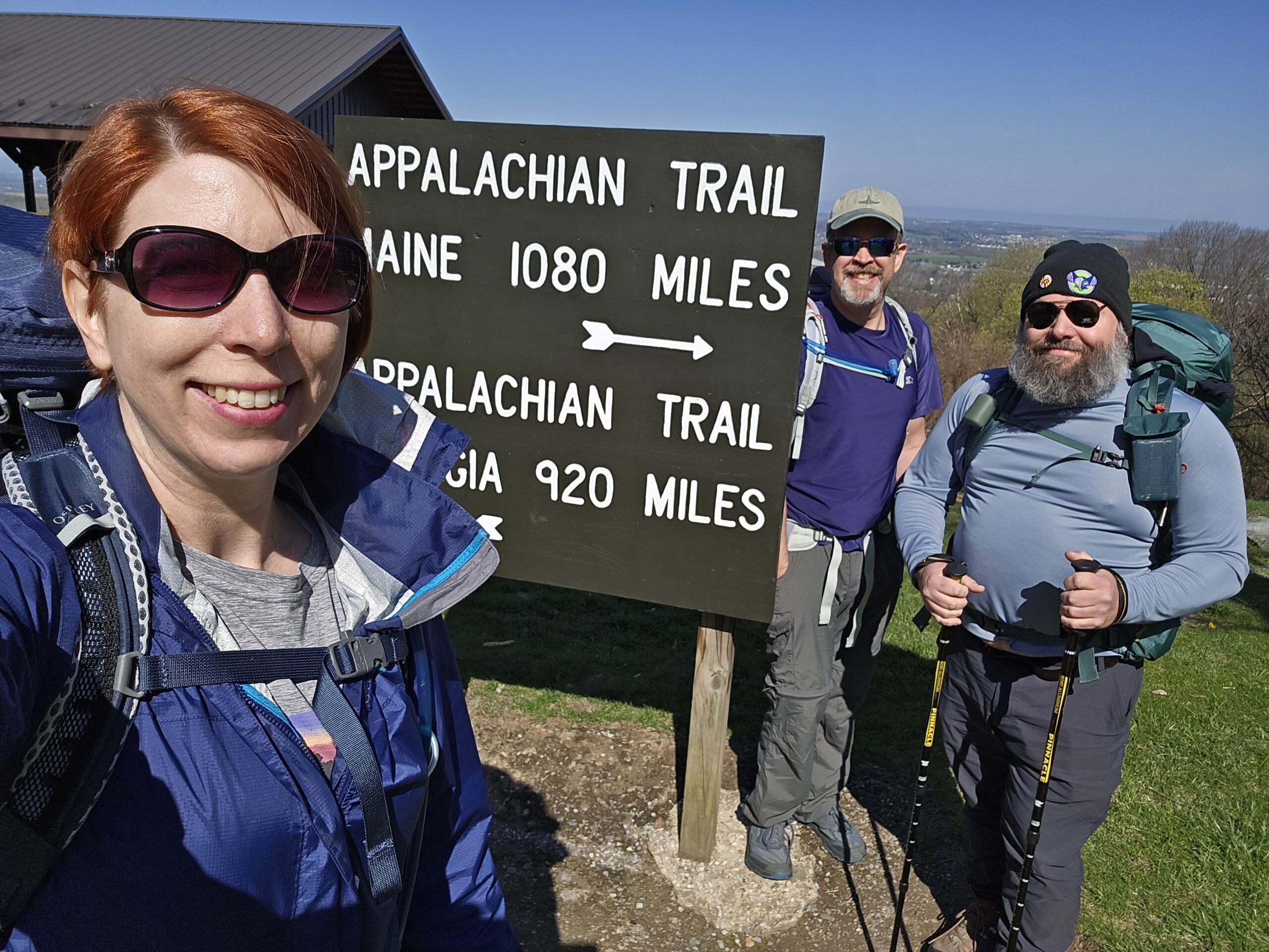
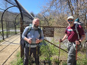
Our journey began at Penn-Mar, by the border. We had to get a free parking pass to park overnight at the lot across from the park. At 10 am on Friday, the restrooms and other park amenities were closed. We took a picture at the sign, enjoyed the vista, and went on our way. The first couple of miles weren’t too bad, and we kept a decent pace.
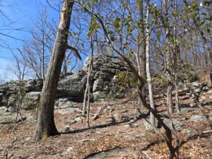
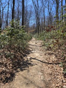
The ascent to Raven Rock took a bit out of us. As you go up, you will gain more than 500 feet in 4/10 mile climbing up a boulder field. Once you get to the top, you walk the ridge a bit and can take a detour to High Rock before you hit Raven Rock shelter. Raven Rock is a nice spot to take lunch, use the privy, and relax before heading downhill. Unfortunately, the insoles I bought to make my hiking boots “comfier” left my toes almost numb. At this point, I switched out to my sandals with socks.
Raven Rock to Ensign Cowall Shelter: 4.9 miles
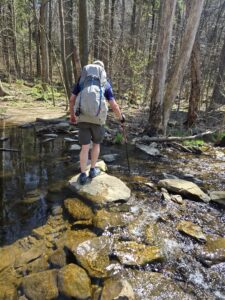
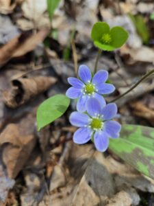
I didn’t have as much trouble going up to Raven Rock, but coming down hurt my thighs a lot. By the time I got to the road, my legs were quaking. I think the descent is around 800 ft. Luckily, you will cross the road, walk along the edge and hit Antietam Creek. It is a nice, cool mountain stream that is perfect for a break after the strenuous hike down the hill. The area was flush with ephemeral wildflowers which made me happy. You can also refill water here. Sometimes, it is difficult to cross this section so prepare to wade through or use the signs to detour past the high water. We were able to jump across the stones just fine.
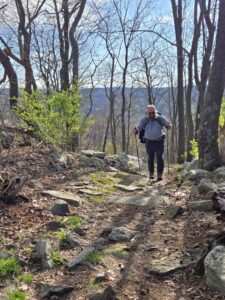
After our break, we continued up the hill. It wasn’t too bad, and there was an old stone wall that reminded us of previous times when the land was formerly farmed. There is a divine flatter section that lets you regain your breath before sharply descending, yet again, another 200 feet or so. We hit an unpaved road and then gained 500 feet in elevation across ½ mile or so. From there, we weaved through forests and boulders, went across a powerline cut, crossed another road, and then walked across a mowed field. This actually was a bit of relief for me as I could see a ¼ mile of flat ground even if it was boring scenery. We were all starting to get hungry and tired at this point. We went back into the forest, climbed a little more uphill, then started to go back down again until we hit Ensign Cowall Shelter. The climb down was rocky, and it was hard not to go fast to get to the relief waiting for us at the shelter. I had to be extra careful since I was in hiking sandals.
Once we got to the shelter, we immediately began making dinner. We all were ravenous. I made these peanut noodles for the group. I didn’t get the lime packets, so we used some of the ramen seasoning to give the noodles a little more salt. It HIT THE SPOT.
The boys were exhausted, so we just chatted a little with the other campers and decided to set up shop in the shelter rather than pull out the tents. Dan and Jon used the 2nd floor of the shelter, and I slept below. I had a terrible night of sleep, but I did get to see bats enjoying the evening buffet before the light died out.
Ensign Cowall Shelter is close to good water sources and has a new privy. I definitely suggest stopping here for a night of rest!
Ensign Cowall Shelter to Pogo Campsite: 5 miles
This hike would have been easy if we were better prepared, physically, for the trip. Jon and Dan were very sore. My feet weren’t the happiest, but we continued on. We didn’t pack much water because we knew we only had 5 miles until the next water source. I wore my sandals.
We hiked down to Wolfsville Road, crossed, and were met with a small grove of hemlocks and wildflowers. From there, the trail has a sharp ascent that covers 500 feet in elevation in ½ mile. Boo! Thankfully, the rest of the trail was relatively easy. We had several miles of mostly flat trail with few rocks but eventually hit a section where you had to rock hop to deal with the large rocks on the trail. I affectionately was named a billy goat because I love rock hopping and got quite a bit ahead. The trail has some ups and downs but nothing too strenuous in this section. You’ll eventually go downhill and hit Pogo campsite.
Pogo campsite is on a hill and just offers tent spots. It does have a nice rock wall for sitting and enjoying lunch right by a stream you can use to refill your water.
Pogo Campsite to US Highway 40: ~4.2 miles
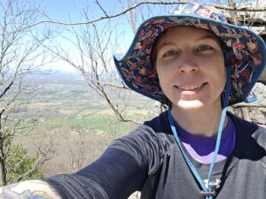
Black Rock Cliff is a short ascent from Pogo. It was refreshing to hit a vista so early from our rest point. The view was stunning, and I suggest the very short detour.
From Black Rock, the next point of interest is Annapolis Rocks. You’ll go through a sea of mountain laurels which will be lovely in May, and then hit the trail spur. At this point, the boys didn’t want to do the side excursion. So, we missed out on the views. I switched back to my boots expecting we would be hitting some rocks moving forward.
We started to cross by a lot of day hikers at this point. Their tiny packs made me a bit jealous. Like other sections of the trail, there were up and down points until we kept going down to hit Pine Knob shelter. At this point, my feet needed mole skin. Dan and Jon were also beat. It was 2pm. We didn’t want to spend the rest of the day at the shelter. We also didn’t have it in us to continue the 5.5 miles to Dahlgren campground. I made the suggestion to detour to Greenbrier campground, but Dan and Jon were done.
So, we rested and chatted with a lovely through hiker who had done the trail before and just retired a week ago. He had hiking plans through 2031 which included the Triple Crown and a few other, longer trails.
After everyone got snacks, water, and a needed break, we continued the half a mile to the parking lot and got an Uber to Jon’s van. Our trip was over.
Lessons Learned
I think our biggest lesson was that we all needed to better prepare for the hike. We had practiced with packs for ~2 miles around the neighborhood here and there, but it wasn’t the same as the steep ascents and descents we would experience. We all slightly overpacked, too. Extra items I didn’t need included a microfiber towel, multi-tool, cards, etc. Combined, those items added over a pound of weight I didn’t need. I also hiked with more water than I needed. Finally, while I had another day in me, my shoe situation would have been the end of my trip regardless. Test out those insoles before starting a long trek!